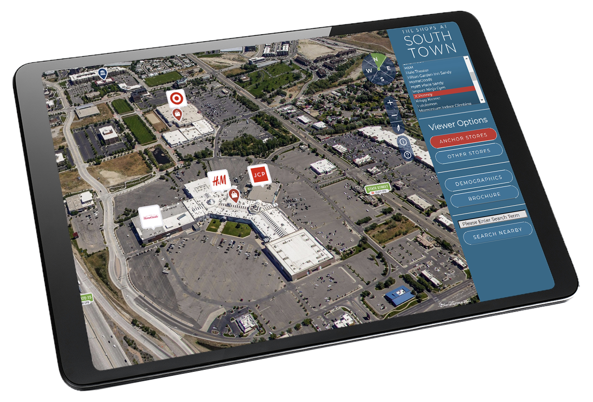
Geo-Enabled Panoramic Tours
Bring Your Properties to Life with 360° Interactive Experiences
Meet XP360
XP360 transforms 360° imagery into immersive, map-based experiences ideal for showcasing properties, development projects, and economic opportunities.
Compatible with aerial and ground-based 360° imagery, XP360 lets developers integrate interactive, geospatially accurate tours into websites, applications, or dashboards.
Highlight key assets, visualize future plans, and engage stakeholders with compelling, location-smart storytelling. Whether you’re building your own solution or working with our team on a custom implementation, XP360 makes it easy to deliver stunning, data-driven experiences tailored to your goals.

Smarter Virtual Tours
Why XP360? Because it does more with less effort
XP360 makes it easy to showcase properties and development projects in a single, interactive experience. You only need one set of markers, boundaries, or parcels to work across every view, so there’s no need to recreate data for each angle. And because XP360 can connect to live sources like MLS or sales databases, updates happen automatically keeping your content current, consistent, and easy to manage.
Easy Integration
Get Started with XP360
XP360 is a flexible JavaScript API that lets you embed immersive, map-based 360° imagery into your websites, dashboards, or custom applications. Whether you’re building interactive site tours, showcasing development projects, or enhancing GIS tools, XP360 gives your team the tools to make it happen.
Who It’s For
XP360 is built for developers, GIS teams, and agencies looking to integrate powerful visual storytelling into their platforms. Our most successful users include:
- Real estate and proptech firms
- Commercial developers and marketing agencies
- GIS dashboard and analytics providers
- Municipal and AEC teams working in planning and engagement
Want to learn more or see how it fits your project?
Fill out the short form below—we’ll connect you with the right resources, from integration guidance to custom project support.

Curious about XP360?
Drop us a line. Whether you’re ready to integrate or just exploring what’s possible, we’ll help you understand how XP360 fits into your workflow.
Drone Partnerships
Capture Imagery.
Grow Your Services.
Expand Your Impact.
Do you want to provide 360° data to our customers? Elevate your offerings with an XP360 partnership. For drone pilots, engineering firms, and marketing professionals, our immersive platform can open new revenue streams and deliver a competitive edge in your industry.