Oriented Imagery Update: What You Need to Know

In the world of GIS, data visualization is everything. But what if you need to see a site from a new angle—literally? Esri’s recent evolution of Oriented Imagery is poised to revolutionize the imagery landscape, transitioning from a specialized toolkit to an integrated core feature that makes non-traditional views, ranging from oblique to 360°, more accessible than ever.
What is Oriented Imagery?
Oriented Imagery (OI) is a term used by Esri to describe the means of integrating non-orthographic imagery (not top-down) into ArcGIS. Unlike satellite, aerial, and other nadir imagery, which can be mapped directly to the earth’s surface, oblique imagery must take into account perspective, distortion, field of view, the horizon, and many other variables.
This is not the first time non-orthographic imagery has been introduced into GIS, but early attempts were created by data capture companies, and their solutions typically applied only to their own data and customer solutions. Esri set out to create a native viewer that could handle any type of imagery, including oblique, panoramic, and 360-degree views. This ambitious goal lowers the barrier to entry and heightens data integration efforts.
Making it possible for ArcGIS users to visualize this data directly is an ambitious endeavor, as it needs to not only support all the different image types and formats but also account for the fact that few standards exist for how critical metadata information is stored and formatted. The process of finding and interpreting the metadata can vary significantly depending on the sensor used. While high-end sensors typically produce excellent results, consumer-grade devices can also capture the necessary metadata.
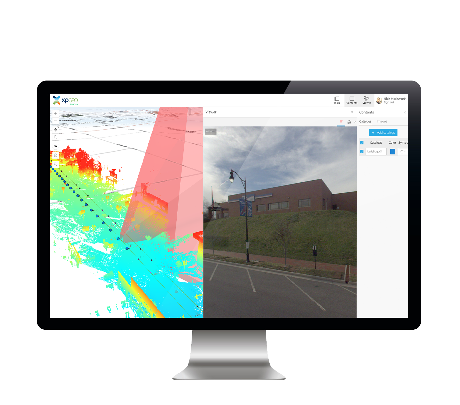
Your smartphone or GoPro, for example, is equipped with a camera and position and orientation sensors, making it a powerful remote sensing device capable of collecting the raw data needed to create OI data. To streamline this process, solutions like Esri’s QuickCapture and AerialSphere’s XPGEO Studio automatically interpret this critical metadata, empowering users to quickly and easily create OI layers from their imagery.
What’s Changing?
The initial OI releases were a powerful tool for those who took the time to understand the unique schema. Imagery was processed and turned into Oriented Imagery Catalogs (OICs), a format unique to this release. It worked well with ArcGIS Pro if you added the Oriented Imagery Toolkit, and it was supported in the new-at-the-time Experience Builder (Esri’s replacement for the venerable Web AppBuilder), but its use was limited mostly to those two applications. Despite its limited interoperability, this version (now referred to as Oriented Imagery Classic) was feature-rich and supported a wide range of imagery types, from obliques to video. AerialSphere was an early adopter of OI and, like others who have taken the time to understand it, the potential benefits are clear.
Every product evolves, and Esri is responding to the demand for more integration and has released a replacement for the original OIC format. This new version is known as Oriented Imagery Layers, or sometimes referred to as “Oriented Imagery Integrated”. This new format behaves like a standard operational feature layer in ArcGIS, and it promises to vastly expand the reach of OI into more parts of the Esri Ecosystem. At the time of writing, this includes Map Viewer, ArcGIS Indoors, Instant Apps, and the Living Atlas. Additionally, it facilitates easier interoperability with third-party apps, such as those offered by CityWorks and VertiGIS. In this way, OI has moved from a specialized add-in to a core, well-supported feature. This is a substantial benefit to both Esri partners and users.
What Does it Mean for Existing Users?
If you are familiar with OI, the good news is that there is little difference in how content is created. In fact, the toolkit and viewer are even more well incorporated into ArcGIS Pro. While the fundamental creation steps remain similar, the output is now a single layer that will be identified as an ‘Oriented Imagery’ layer in your ArcGIS Contents, simplifying file management and organization.
Existing users will find that the parity between OI Classic and OI Layers is close; however, some image formats and features may not yet be supported in both ArcGIS Pro and ArcGIS Online. Users are encouraged to check Esri’s official documentation for the latest release notes, as those features are continually evolving.
As for those organizations currently using OICs, the new integrated layers provide a clear path forward. While OI Classic will continue to function as expected for the foreseeable future, Esri’s development efforts and new feature releases are now focused exclusively on the new OI Layers. To take full advantage of future improvements and ensure long-term compatibility, it is highly recommended that users begin using the new format.
For users seeking alternative workflows, there are ways of creating OI Layers without requiring access to ArcGIS Pro. For example, Esri’s own ArcGIS QuickCapture can be used for field data collection, and solutions like the latest version of the XPGEO Studio from AerialSphere are specifically designed to streamline the production of these new OI Layers. One of the key advantages of XPGEO Studio is that it automatically detects metadata for the most popular remote sensors, simplifying a previously time-consuming task. XPGEO Studio remains one of the simplest methods for quickly processing and configuring your oblique, 360°, handheld, and drone imagery, automatically generating the fully compatible layers required for direct publishing into your ArcGIS environment.

What Does it Mean for New Users?
It means now is the best time to start leveraging this incredibly useful data visualization technology. More and more organizations are collecting imagery data, but managing, sharing, and providing intuitive access to that imagery can be a challenge. The foundation has been laid for ever-increasing adoption and implementation. Imagery like this isn’t just important when an incident occurs; there must also be a record of what was. Imagine capturing every detail of your equipment, facilities, or community on a regular cadence and being able to easily draw upon that history, and having a record of what was there.
Furthermore, OI is not intended to replace other powerful remote sensing technologies, such as LiDAR and full 3D photogrammetric models; rather, it serves as a complementary visualization tool. Because OI layers are relatively lightweight in terms of memory and bandwidth, they offer a highly accessible and efficient way to explore sites, unlike gigabyte-sized point clouds or 3D meshes that require significant computing resources to render. OI layers can serve as an intuitive gateway for navigating and understanding a site before delving into more data-intensive models.
Integrating Esri’s native utilities with streamlined third-party solutions, such as AerialSphere’s XPGEO Studio, lowers the barrier to entry for leveraging this powerful visualization technology and creates more opportunities for wider user adoption across various aspects of GIS.
AerialSphere is a pioneering company in the geospatial technology sector, specializing in Oriented Imagery technology. Our innovative software solutions are designed to unlock the full potential of various types of imagery, providing intuitive and powerful tools for businesses, governments, and organizations. AerialSphere’s technology enhances decision-making processes, operational efficiency, and user engagement by offering easy-to-use and highly functional mapping solutions. Committed to accuracy, innovation, and customer satisfaction, AerialSphere is transforming the geospatial industry. For more information, visit www.aerialsphere.com.


