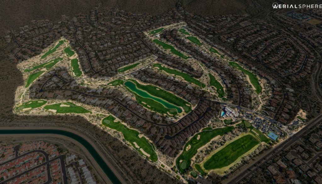
Golf Courses Benefit From Aerial Photography

With the Waste Management Phoenix Open coming to AerialSphere’s backyard (Phoenix, Arizona) next week, let’s explore how our imagery can be used to showcase golf courses, country clubs, and resort communities.
Maps, street views, and drone images do a fine job of showing different perspectives of a community. Our unique imagery compliments those traditional methods by giving a larger perspective. Here are a few ways to utilize our imagery in your golf course or community:
Create a Custom Virtual Tour
Use our API (XP360) to create an entire 360-degree experience for customers and host it on your website. Really give golfers and future home buyers a vision of what your property has to offer. You can use our premade markers to highlight your clubhouse, golf holes, tennis courts, pool, etc.
Replace that Map with an Aerial Photo
Instead of a course map on your website, you can take a Snapshot of your course from our collection and display a real image. After you take a Snapshot, you can bring the photo into the image editing software of your choice to add labels, hole numbers, or other information(shown above). Or combine the two to create an interactive map that also real aerial images of each hole.
Our Imagery isn’t Confined to your Website
XP360 subscribers can use our imagery and snapshots from it for marketing collateral, social media, and email. With our 360-degree imagery, we’ve seen a growth of over 5x in social media impressions and 7x in engagement.
We built our software with real estate in mind, and that includes golf communities. Give our imagery a try today with our free trial. Contact us at sales@aerialsphere.com to learn more.
About AerialSphere
AerialSphere is the only company to combine 360-degree aerial imagery with location data, giving companies new vantage points to make better-informed decisions. Built upon nearly a decade of research and patented technological innovation, AerialSphere is changing how companies plan, develop and market their properties, products, and services.
Our dedication to innovation has positioned us as a driving market force in a number of industries including real estate, government, retail, insurance, and entertainment. AerialSphere has been trusted by four of the top five commercial real estate brokerages and continues to be recognized for its innovative technology.
To learn more about AerialSphere, visit aerialsphere.com.


