City of Mesa Leveraging XP360 On Demand in Their Smart City Initiative

Government agencies are increasingly turning to immersive aerial imagery to solve city-planning conundrums and help them transition and meet their smart city goals. A Smart City is one in which the latest technologies and data-driven insights are leveraged to improve the quality of life, civic engagement, economic development, service delivery, and community vibrancy for its citizens, businesses and visitors. The City of Mesa has been working diligently to engage their citizens, businesses and the public as they identify the strategies & priorities for building a Smarter Mesa.
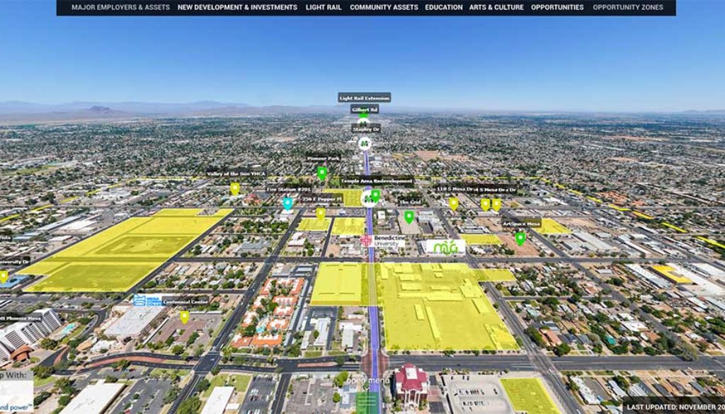
 The city of Mesa has been leveraging AerialSphere’s immersive experiences as a powerful tool for their smart city initiative focusing on city planning and economic development for a number of areas in their city. It allows visitors to their website to Experience Mesa’s Business Districts from a 360-degree, interactive, birds-eye view, and explore what makes each district an ideal place to locate and grow a business.
They have been leveraging XP360 OnDemand to create spheres to help drive relocation, employment, development and awareness to their city. The XP360 OnDemand spheres help them highlight facets of each business district within the immersive experiences – some of the informative data they have been overlaying includes:
- Major Employers & Assets
- New Development & Investments
- Light Rail
- Community Assets
- Education
- Arts & Culture
- Opportunities
- Opportunity Zones
View AerialMesa Experiences here:
- Downtown Mesa
- Riverview District
- Fiesta District
- Falcon District
- Falcon Field Airport Directory
- Gateway Area North (Elliot Road Technology Corridor)
- Gateway Area South (Pecos Zone, Gateway Airport)
Visit the City of Mesa’s AerialMesa page here: https://www.selectmesa.com/business-districts/aerialmesa


