Menu
AerialSphere
Visualize More. Achieve More.
  • GIS Solutions
  • 360° Imagery Solutions
  • Professional Services
  • Resources
    • Contact Us
    • FAQs
    • XPGEO Documentation
    • XP360 Documentation
    • Blog
  • Sign In
Close Menu
October 19, 2020

The City of Buckeye Promoting Their Opportunities with XP360 on Demand

buckeye-screenshot

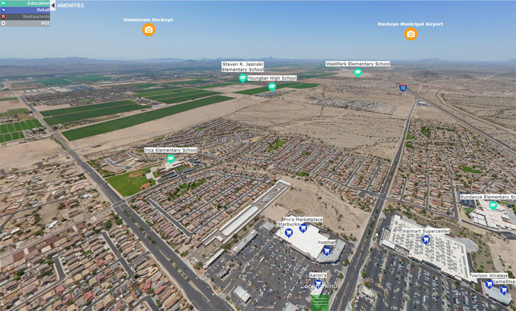
A big challenge for city governments is promoting opportunities in their city to others that may not be able to easily travel there. The City Buckeye has a lot to offer and decided to take advantage of XP360 on Demand from AerialSphere to show off their amazing city and all it has to offer. XP360 allows the City of Buckeye to provide visitors with an engaging and informative aerial experience of their city, showing off points of interest including, restaurants, education, retail and more.

Now people can enjoy the city from thousands of miles away as if they were floating around the city themselves. Their immersive sphere, or as they call it: “Buckeye from the sky” can be found on their website here: https://www.growbuckeye.com/research-data/maps-publications/aerial-maps/-fsiteid-2.

Related Posts

FP_EmbedXP360_1280x800

Integration Notes, XP360 Information

Welcome to the XP360 Jumpstart Package

FP_AS_embed01

Integration Notes, XP360 Information

Embedding XP360 in Your Website or Blog

FP_SnapshotHD_1080x640

Integration Notes, XP360 Information

Introducing SnapshotHD

CATEGORIES

  • Airports
  • Case Studies
  • Coverage
  • Entertainment
  • Federal
  • Headquarters
  • Industry Information
  • Integration Notes
  • Partners
  • Points of Interest
  • Points of Interest
  • Press
  • Sports Venues
  • Technology
  • Uncategorized
  • US Cities
  • XP360 Information

SEARCH

AerialSphere

Unlock the full potential of your drones, cameras, and other sensors with our imagery solutions.

Find us On…

Solutions

  • AerialSphere for GIS
  • 360° Imagery Solution
  • Professional Services

Company

  • About Us
  • AerialSphere Blog
  • Careers
  • Contact Us
  • Sign In
© 2023 AerialSphere. All rights reserved   |   Privacy Policy  |   Terms of Use   |  Legal